![]() info@rusticfrontiers.bt
info@rusticfrontiers.bt ![]() +975 17784494/17349862
+975 17784494/17349862
Druk path Trek
- Home
- Trekking Tours
- Druk Path Trek

OVERVIEW
Duration: 4 Nights 5 Days
Trek Route: Paro – Thimphu
Altitude gain – 3,503ft/1,068m, Altitude loss – 269ft/82m
We’ll meet our trek crew and horses above Ta Dzong. Today’s trek involves a steady climb of 1,065 meters, followed by a descent over 80 kilometers to camp. This challenging effort at high altitude requires patience and hydration. The trail ascends steeply through blue pine forests, past farmhouses and apple orchards.
After about an hour of climbing, you’ll enjoy views of Paro Valley and Jele Dzong perched on a nearby ridge. At 2,995 meters, after about two hours of trekking, you’ll pass a mani wall in a grassy field, which could be a potential campsite but has limited water. Continue climbing through blue pine, fir, and bamboo forests until reaching a small pass at 3,518 meters. The campsite, located at 3,436 meters, is slightly below the pass and can be cold due to afternoon winds. You might hear monks playing instruments during their prayer sessions at a nearby lhakhang.
Altitude gain – 1,726ft, Altitude loss – 0ft/0m
From camp, climb back to the ridge and cross the pass leading to Jele Dzong at 3,595 meters. The eastern valley of Gidakom, with its historic hospital, and several lakes are visible. After a brief exploration, head North along the ridge, passing through a forest affected by bark beetles. Cross to the Eastern side of the ridge at 3,700 meters, ascend a small peak to 3,750 meters, and enjoy views of Paro Valley and the Dagala Range. After about 3 hours, reach Jangchu Lhakhang at 3,770 meters, and continue for another hour to the better campsite at Tshokam, 3,962 meters, just past a small saddle.
Altitude gain – 700ft/213m, Altitude loss 965ft/295m
The ridge walk, which is about 2 hours longer than the pack animals’ route, offers more spectacular views, weather permitting, including snowy peaks to the North and a grand view of the valley. After a gentle climb for several hours, reach a small pass at 4,070 meters, followed by a short descent to the Labanah campsite. Continue along the ridge to another small pass at 4,080 meters, with views of Jhomolhari to the North and Jimilang Tsho to the South. At 4,175 meters, a small stone shelter by a lake is reached, surrounded by yak herder shelters and trails. Two trails lead to Jimilang Tsho; the higher, more challenging trail is recommended despite being overgrown. A good campsite is located on the lake’s east side at 3,880 meters, where locals often fish for trout using bamboo spears.
Altitude gain/loss several small ups and downs.
Walk around the lake to its western end, where a split in the trail leads either along the pack animals’ route or up steeply above the lake. After climbing through bushes, an exposed cliff trail reaches a saddle at 4,100 meters with views of Jane Tsho, about 1.5 to 2 hours away. From Jane Tsho, follow a stone path through rhododendrons to Dungtsho Tsho and Dungtsho Sama lakes. The female lake is believed to have a powerful spirit that causes bad weather if polluted. Climb for about an hour to a viewpoint at 4,150 meters, overlooking Simkota Tsho, where you’ll camp for the night.
Altitude gain – 755ft/230m, Altitude loss – 1,330ft/405m)
The trail involves seven minor climbs to small passes before offering a view of Phajoding Monastery and Thimphu. Monks often pass this way en route to meditating at the sacred Jimilang Tsho lake.
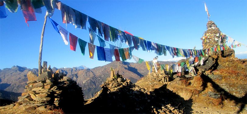
From the pass, climb 250 meters to a rocky outlook at 4,320 meters, covered in prayer flags and formerly used for sky burials, offering stunning views of the Bhutan Himalayas. Descend slightly, then climb to another pass at 4,095 meters, where strong winds prevail. This pass provides a final view of the steep descent to Phajoding Monastery and Thimphu.